3D data is the future of geographic information systems. The third dimension offers analysis capabilities that further enhance the power of location data. Avineon is here to help you make the transition to 3D!
3D geospatial data engineering is the field of expertise that deals with the collection, analysis, modeling, and visualization of 3D geospatial data. This data encompasses information about the height, width, and depth of objects. Avineon boasts extensive experience in optimizing the utilization and management of 3D data.
Avineon's 3D geospatial data engineering expertise is your solution when you:
Seeking to model assets such as pipelines and infrastructure objects in 3D;
Or seeking to implement 3D in other ways to elevate your GIS project to the next level.
Why choose Avineon for 3D geospatial data engineering?
Transparency regarding agreements and pricing;
Cost-effectiveness achieved through a large and experienced 3D team;
Proof of concept: testing first, then development;
Rapid delivery.
3D Geospatial Data Engineering: best practices
Avineon boasts a proven track record in delivering 3D city models and other 3D projects across the Netherlands, Belgium, and beyond. A selection of our portfolio is showcased below.
Imagine your city in 3D!
3D city modelling empowers UK municipalities to unlock a new level of urban planning, management, and citizen engagement. By creating a digital replica of your city, you can visualise infrastructure projects, analyse development opportunities, and improve decision-making – all with stunning clarity and accessibility.
The housing sector faces a critical challenge: balancing resident comfort with environmental responsibility. Digital twins offer a powerful solution. These virtual replicas of buildings provide real-time data on energy consumption, identify areas for improvement, and even simulate the impact of potential upgrades. Empowered with this knowledge, housing associations can optimize energy usage, reduce their carbon footprint, and create a more sustainable future for residents and the planet.
Avineon boasts more than 30 years of experience supporting organisations across sectors including transport, utilities, telecoms, and those maintaining critical infrastructure.
Over the past three decades, we've assisted 300 organisations in enhancing their location-related IT processes.
Download our e-book "Why Avineon?" to delve deeper into our approach.
Avineon boasts more than 30 years of experience supporting organisations across sectors including transport, utilities, telecoms, and those maintaining critical infrastructure.
Over the past three decades, we've assisted 300 organisations in enhancing their location-related IT processes.
The knowledge we gain is directly applied across diverse industries.
Download our e-book "Why Avineon?" to delve deeper into our approach.
Avineon specializes in large-scale asset digitization projects. Our smart data integration and cost-effective digitization processes, executed by our expert teams in India, enable us to import vast amounts of legacy data into your GIS at relatively low costs.
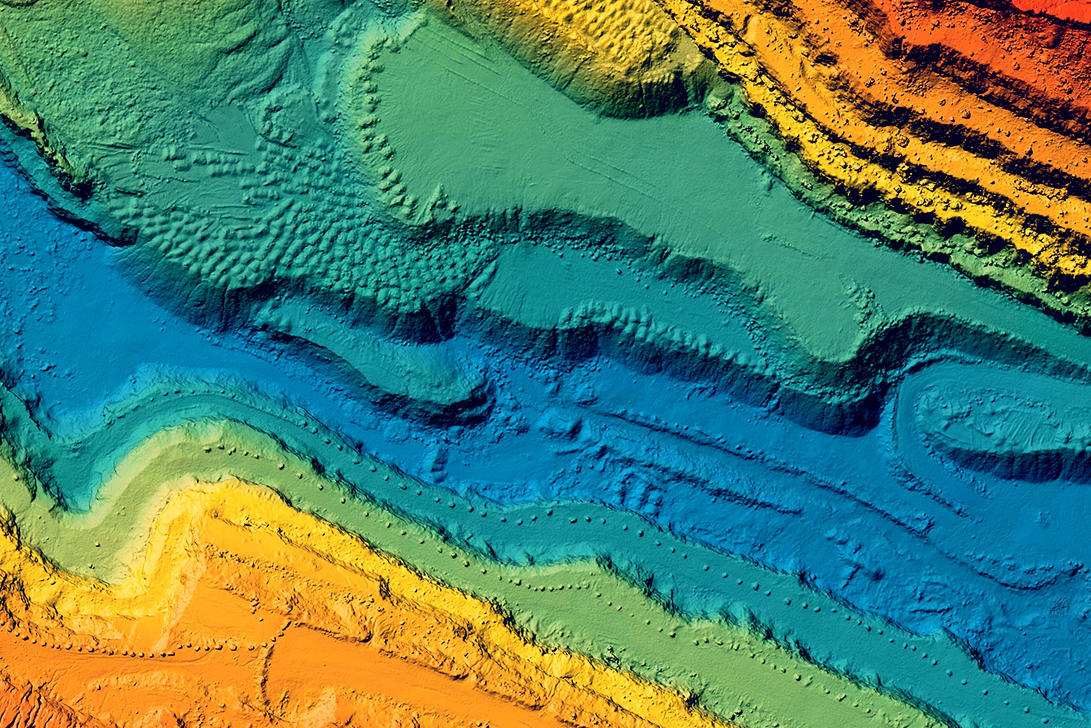
Lidar data classification is a specialized skill. Avineon boasts extensive experience in lidar projects related to 3D city modeling and vegetation monitoring. We are eager to apply our expertise in raster analysis to your GIS project!
Avineon is an international organisation with more than 3o years of experience in geographic data projects. In 1992, Avineon started as an early adapter of GIS in the United States and we now operate in multiple countries in Europe.