3D City Modeling

Avineon boasts an international track record in creating 3D city models. We've meticulously replicated cities like The Hague, Rotterdam, and Brussels in 3D. Is your UK municipality next?
What is a 3D city model?

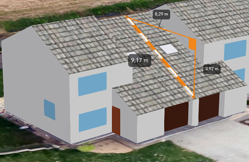
A 3D city model is a digital twin of a city and its infrastructure. The geometric data of our 3D city models is accurate to within a few centimeters and seamlessly integrates with large-scale base maps and digital terrain models. We employ automated object detection to enrich the data about the depicted buildings. Using this technique, we add features such as skylights, solar panels, chimneys, or other building characteristics.

3D city models best practices Avineon

Avineon has an international portfolio in the field of 3D city models. The following cities have been visualised by us:


  • Rotterdam (Netherlands);
  • The Hague  (The Netherlands);
  • Groningen  (Netherlands);
  • 's Hertogenbosch  (The Netherlands);
  • Brussels  (Belgium);
  • Montpellier  (France);
  • Genève (Switzerland).


What is the added value of a 3d city model?

3D city models serve a number of purposes. You can use them to visualise planned urban developments in a realistic way. Using this visualisation, you can analyse the impact on shading, traffic and safety or mobile reception. This is invaluable during the urban planning phase.


A 3D city model is also a powerful tool for city marketing. A 3D visualisation captures the imagination of internal and external stakeholders. This ensures faster decision-making processes.


Finally, a 3D city model is a powerful tool for advanced GIS analyses  where the third dimension plays a role. This is particularly relevant for urban planning projects with a sustainable goal.

Would you like to add your city to this list? Avineon will guide you through the entire process of developing a 3D city model. We identify the need, guide you in creating the 3D city model and set up a post-implementation management process.

Why Avineon

Avineon boasts more than 30 years of experience supporting organisations across sectors including transport, utilities, telecoms, and those maintaining critical infrastructure.


Over the past three decades, we've assisted 300 organisations in enhancing their location-related IT processes.


The knowledge we gain is directly applied across diverse industries.


Download our e-book "Why Avineon?" to delve deeper into our approach.

Avineon Data Engineers overleggen over een 3d stadsmodel achter een pc

Contact us