-
Engineering Support
- Digital Modernization
- Spatial Intelligence
- Industries
Select your location
This selection helps us tailor your visit on the website by providing you with localized information.

This selection helps us tailor your visit on the website by providing you with localized information.

Are you one of the many municipalities that is struggling with a manual, long, and inefficient building design validation and approval process? Are you trying to start your journey towards a BIM-based design validation and approval process in an easily accessible and seamless environment? Is a lot of legacy building design information still handled in paper format or as independent CAD/PDF files?
Discover how the implementation of a GeoBIM for the Municipality of Ajman enabled the digitalization and automation of the submission, validation, and permit process by integrating Building Information Models (BIM) and geospatial technology to derive business value out of legacy building plans!
Customer: Ajman Municipality
Region / Country: United Arab Emirates (UAE)
Industry: State and Local Government
Solution: GeoBIM

This project was executed for the Building Permit department of Ajman municipality in the United Arab Emirates.
This department is responsible for the issuing of Building Permit Approvals as well as the management and maintenance of building plan / permit drawings. They partnered with Avineon to investigate their existing processes and, ultimately, implement a Geo-enabled Building Information Model (GeoBIM).
Digitalization is currently driving the entire society. It is manifesting itself in many process-oriented fields, including urban planning, building permission, and emergency management processes, characterized by a high number of involved stakeholders, both from the industry and authority side. In order to increase efficiency of these processes, it is necessary to digitally integrate information, both between stakeholders and between processes.
The building permission process is, to a large extent, a continuous process where much information is still handled in paper format or as independent CAD/PDF files. With digitalization comes the potential to automate the submission, validation, and permit processes by adopting / integrating Building Information Models (BIM) of planned buildings and geospatial technology – allowing a 3D visualization of the building, and thus making it easier to check if the building complies to building permission regulations and city master plan requirements.
Many entities are still struggling with a manual, long, and inefficient building permission process. The Building Permit department of the Ajman municipality in the United Arab Emirates particularly faced issues in terms of receiving building plan drawings in the form of 2D CAD drawings, which did not facilitate the municipality to visualize building elements in a 3D environment or easily validate plans against building standards. In addition, the 2D CAD drawings also complicated the execution of standard building data analytics based on certain defined criteria.
Avineon partnered with Ajman Municipality as a consultant to study their existing processes, investigate the CAD templates currently in use, and perform a gap analysis with respect to Building Information Model (BIM) standards and readiness to adopt – all in effort to build an enterprise application that enables:
(i) converting 2D CAD files to BIM
(ii) converting BIM to GIS
(iii) develop an interactive BIM viewer application.
The municipality wanted to reap the benefits of an enterprise geo-enabled, BIM-based, 3D building model, that can virtualize a building; starting with the geo-location of the building, over to the validation of building code guidelines for CAD/BIM drawings, and also including the execution of analytics across buildings and regions.
In addition, the municipality wanted to convert existing buildings from archived CAD drawings to a geo-enabled BIM environment to enable a seamless view and analysis.

Avineon worked with Ajman municipality to perform the following tasks:
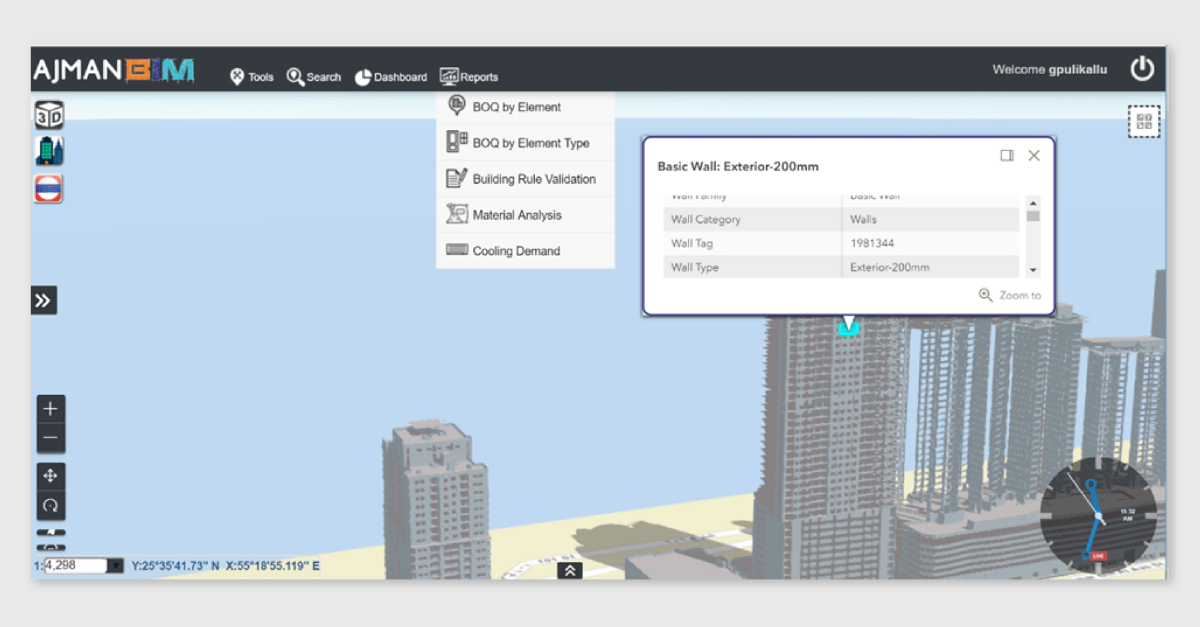
The digitalization of the building permit process does not only set standard templates and specifications to enable multiple stakeholders to submit building designs in BIM up to LOD 500, but also enables to visualize buildings in GIS before approving designs.
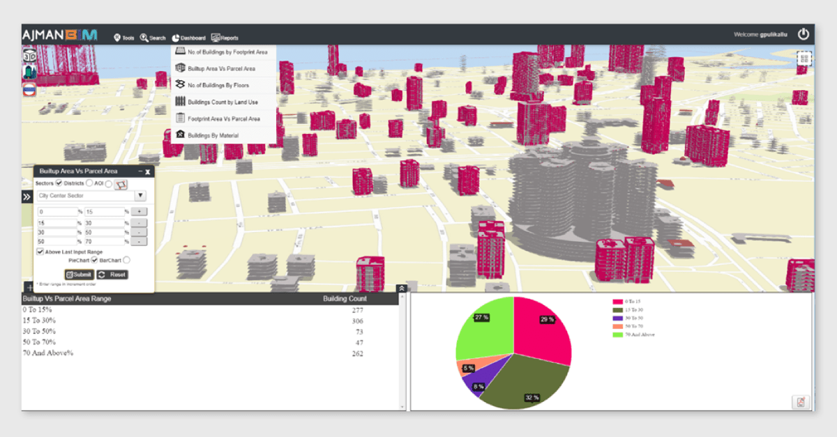
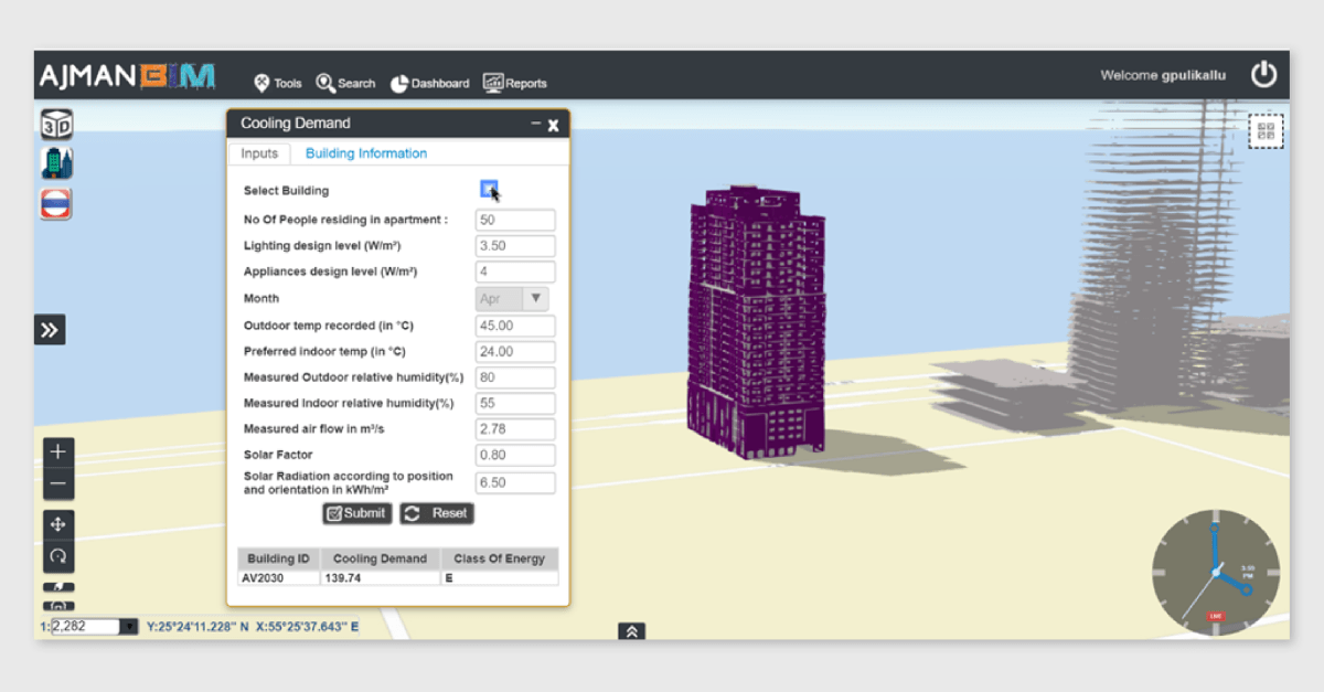
The Geo-enabled BIM helps engineers with the handling of the building permit process, as it allows them to view integrated designs, including utilities, in a seamless web environment. In addition, the Geo-enabled BIM enables the execution of certain analytics, like cooling demand of the building, built-up area vs. parcel area, shadow analysis, Gate level, borewell data (soil analysis), and other analytics which are vital to check before permitting the construction.

Need more information on the GeoBIM subject? Consider downloading our webinar recording, check out our blog series, or contact us!